
In business for better than 50 years, RDO Equipment Co., a national construction and agriculture equipment and technology dealer, has…
Survey
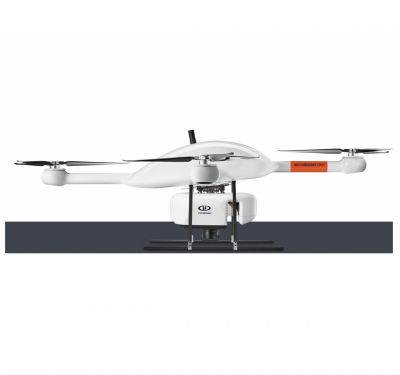
Microdrones to Sell Designed and Made in America Drone Surveying Equipment Starting in 2024
Microdrones to transfer part of its R&D and Manufacturing Activities to Huntsville, AL Following the product launch of the EasyOne…

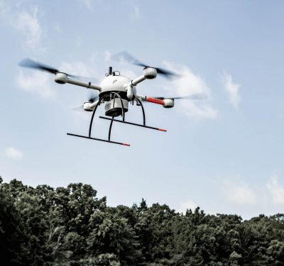
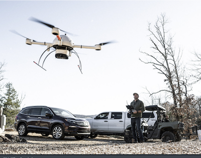
Trends: Drones Improving Inspections
Drones are becoming a common inspection tool across various industries, enhancing efficiencies, providing more accurate data and improving safety.
Propeller Aero, Quantum-Systems Partner
Propeller Aero’s site surveying and 3D mapping software is now compatible with the Trinity F90+ drone from Quantum-Systems, streamlining data…

Atmos integrates Topcon’s hardware and correction services to create an all-in-one surveying solution
Atmos announces a new wide-ranging technical arrangement with Topcon Positioning Group for the supply of Topcon high-end GNSS boards for…
For PNT Integration, Timing Is Everything. Inertial Supplies It.
GPS + inertial + camera + LiDAR + baro-altimeter = a very precise measurement, right? Not when the respective sensor…
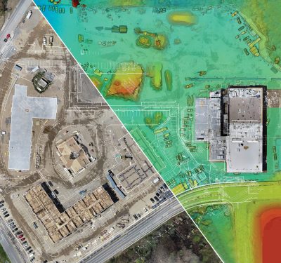
Trends: Surveying and Mapping – From Site to Structure
Drones are being deployed across all aspects of the construction life cycle, with surveying and mapping providing valuable insights from…
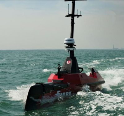
Blue Shadow Autonomous Hydrography Vessel
The Fugro Blue Shadow is a 9-meter long uncrewed surface vessel designed to increase data acquisition efficiency and accelerate hydrographic…
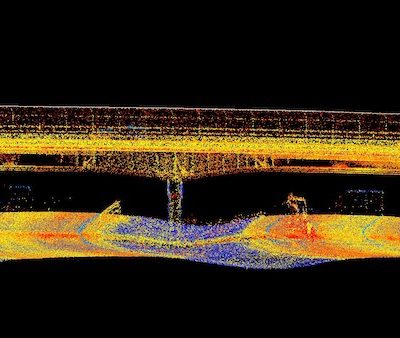
Houston Engineering Deploys Drone-Based LiDAR for Road Surveys
For years, the team at Houston Engineering has deployed drones to collect data for a variety of projects, quickly providing…
Microdrones To Take Off in Vietnam
A well-known Hanoi-based supplier of surveying equipment, measuring devices and services is adding Microdrones surveying equipment to its portfolio. Survey…
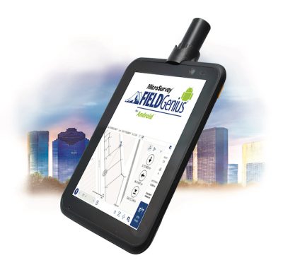
Geneq Inc. Releases SXtab RTK, a New Rugged Tablet for Field Professionals
Geneq is pleased to announce the SXtab RTK, the latest tablet model in the SXtab series. This rugged and versatile…

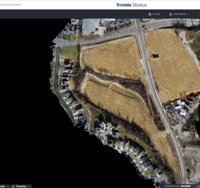
New OEM Hardware/Software for Direct Georeferencing of Airborne Sensor Data
Applanix and Trimble showcase the Trimble AP+ Air OEM solution for Direct Georeferencing of airborne sensor data at the recent…
Measure to Supply Microdrones Surveying Equipment in Brazil
Measure, an intelligent technological solutions provider headquartered in Belo Horizonte, Brazil, has announced they are now offering Microdrones Surveying Equipment…
Microdrones aaS Offers Greater Accessibility, Affordability
Microdrones, the global aerial mapping technology company, is rolling out a major initiative. MdaaS—Microdrones as a Service—provides a broader market…
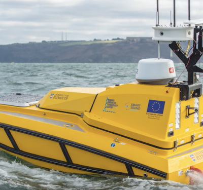
Autonomous Cetus A Goldilocks Craft: Just the Right Size
An autonomous boat cruises the coastal waters off Devon, UK, seeking employment in research and development. Cetus, a C-Worker 4…

Reality Drones: Surveyors Rise to Work Challenges in Video Series
A new online video series and free webinar document the real-life challenges and hazards that professional surveyors encounter using drones…
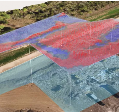
The Hyper Dynamic Virtual World of Civil Construction
The Cincinnati Gardens in Cincinnati, Ohio, was best known as the home of the Cincinnati Rollergirls, Xavier University basketball and…
