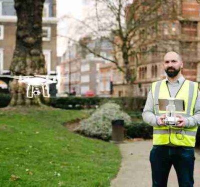
In an effort to deliver clients with faster, better and more cost-effective data, independent building and project consultancy Paragon has…
Air
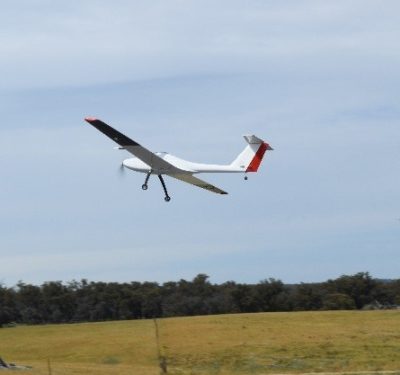
UAVOS Introduces Borey-10 Unmanned Fixed-Wing Aircraft
The new Borey-10 unmanned fixed-wing aircraft from California-based UAVOS features a heated battery component that allows the drone to fly…
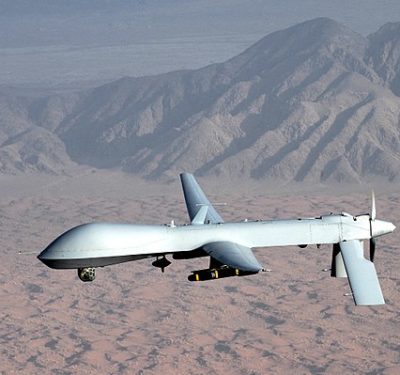
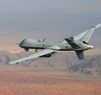
Air Force Replacing RQ-1 Predator Remotely Piloted Aircraft
For more than a decade, the RQ-1 Predator was the primary remotely piloted aircraft used for offensive operations by the…
Drone Emergency Response Conference Set for April
As emergency personnel turn more to unmanned aircraft systems (UAS) during disaster operations, it’s important for them to understand the…
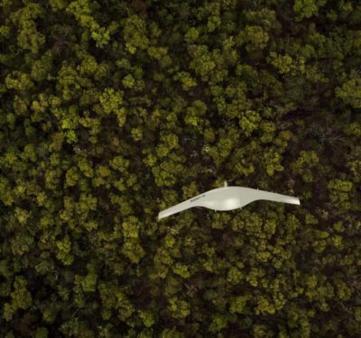
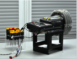
Researchers Fly UAS with Triple Hybrid Propulsion System that Features Hydrogen
A team of Sydney-based researchers recently flew a drone powered by a triple hybrid propulsion system that was made of…
It’s Elemental: Hydrogen Fuel Cells Enable Longer Flights
When one of PINC’s inventory drones canvasses a large ware- house, it moves up and down long aisles as it…

AUVSI XPONENTIAL to Showcase STEM Education and Workforce Development
AUVSI XPONENTIAL, the largest trade show that brings together more than 8,500 unmanned systems industry leaders and forward-thinking users from…
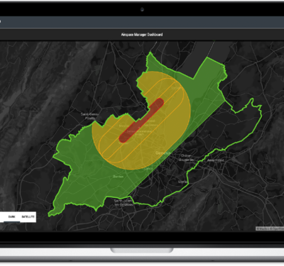
Skyguide and AirMap Partner to Develop First National Drone Traffic Management System for Europe
AirMap and skyguide recently teamed up to develop the first drone air traffic management system in Europe. The first deployment…

Cyberhawk Completes UAS Inspections for Dubai Petroleum
Cyberhawk Innovations recently deployed unmanned aircraft systems (UAS) to inspect more than 350 risers on 63 offshore platforms for Dubai…
Delair and Frontier Precision Sign Expanded Agreement
Delair recently entered into an expanded agreement with Frontier Precision to grow its commercial drone sales and service in the…

Splintered ARC Hands FAA Remote ID Hot Potato
The Aviation Rule Committee advising the FAA on remote identification and tracking of unmanned aircraft left an important question unresolved: to which drones should a new rule apply?

European Space Community Embraces Unmanned Systems
The European space community is embracing its role as an enabler of unmanned technologies. “Satellite communication is becoming indispensible infrastructure,…
Expert Commentary: Watch This Airspace
I’ve been hearing a lot of doom and gloom among the drone expert Twitterati over stalled rulemaking in the Federal…
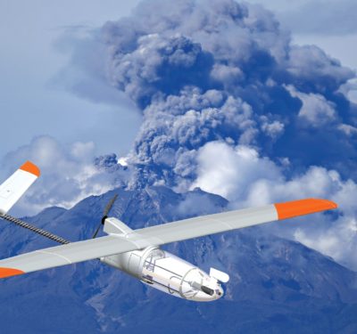
Hot Shots Study Volcanoes and Lava Flows
Researchers are using specially designed sensors and drones to study volcanic plumes and lava flows to better predict the impact of eruptions.

Intel Breaks World Record with Light Show at 2018 Winter Olympics
More than 1,200 (1,218 to be exact) Intel Shooting Star drones took to the skies for the Olympic Winter Games…
Nuclear Industry Putting Trust in UAS
Nuclear facilities are beginning to use UAS for infrastructure inspections, leak detection and site mapping.
CURPAS Represented at the U. T. SEC 2018 Unmanned Technologies Conference in Nuremberg
The U. T. SEC will be opening its doors as the world’s first trade fair and conference on the future…
