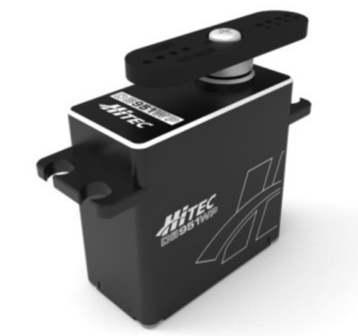
The DB951WP is a high-speed, ultra torque, all metal gear waterproof servo actuator. Featuring a torsionally rigid design and construction,…

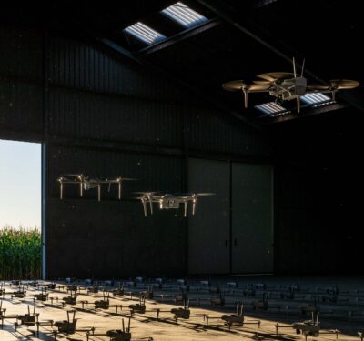
Beyond the Buzz: Addressing the Realities of Drone Sightings with Advanced C-UAS Solutions
Editor’s Note: As attention has increased regarding aircraft activity in the eastern U.S., Inside Unmanned Systems will be providing substantive…

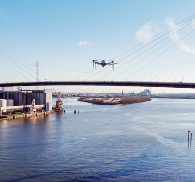
Trainspotting: UAS in Railway Monitoring and Safety
Drone programs in the U.S. and Europe are enhancing railway monitoring, improving efficiency and preventing accidents through advanced aerial surveillance…
uAvionix Casia G Now Detects Aircraft at Night, Enabling 24/7 BVLOS Operations
uAvionix, a provider of aviation technology for uncrewed aircraft systems (UAS), today announced the launch of Casia G Release 4.0,…

Mitsubishi Heavy Industries Delivers Merging Support Information System for Autonomous Trucks
Mitsubishi Heavy Industries, Ltd. (MHI) and Mitsubishi Heavy Industries Machinery Systems, Ltd. (MHI-MS), will participate in Japan’s first trial project…
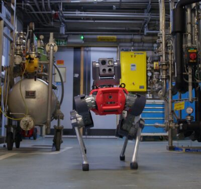
ANYbotics Launches Data Navigator for Energy, Metals, Mining, Oil & Gas Industries
ANYbotics, a provider of AI-driven robotic inspection solutions, has announced the launch of Data Navigator, a new asset management platform that…
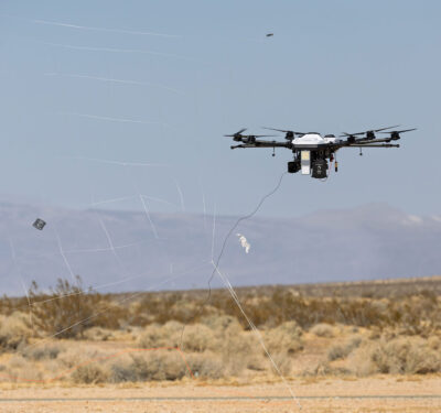
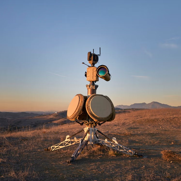
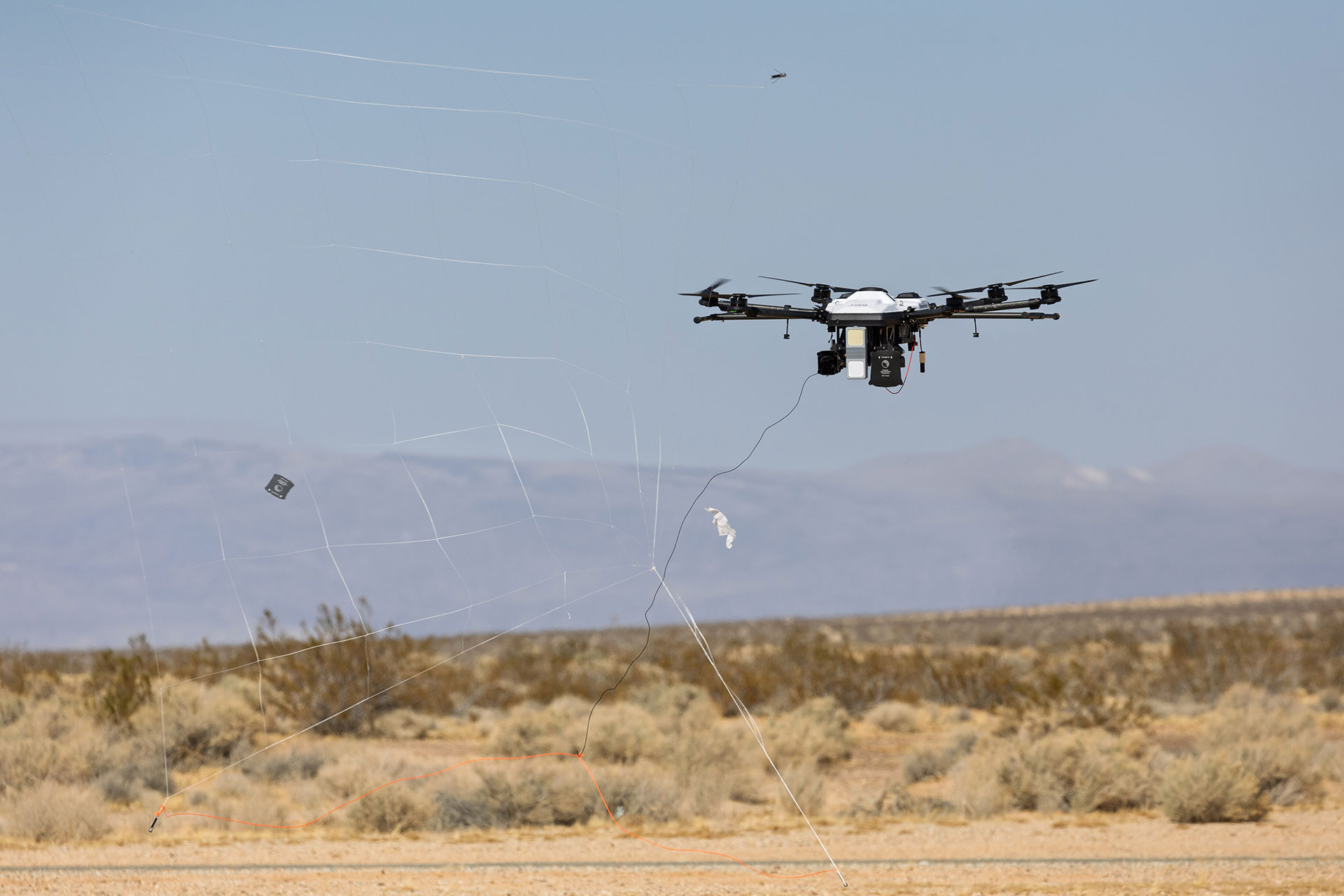
Lockheed Martin Unveils Scalable Counter-UAS Solution
As the threat of small Unmanned Aerial Systems (UAS) continues to evolve, Lockheed Martin is demonstrating a new approach to…

Operationalizing AI for Maritime ISR
As artificial intelligence advances across the defense and autonomy sectors, SAIC is positioning itself as a leader in operationalizing AI…
New Laws Push Drones into Mainstream Inspections
With the 2024 FAA Reauthorization Act and the UK CAA’s new BVLOS exemptions, drone regulations are shifting from restrictions to…
SMAUG Consortium Project to Improve Underwater Threat Detection at Ports and on Maritime Borders
With the aim of improving and reinforcing the security of ports and their entry routes, Indra has launched the European…
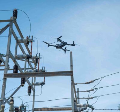
A Critical Tool for Critical Inspections
Drones are proving their worth in critical infrastructure inspections across various industries, including energy, utility and transportation. Systems, payloads and…

UAS for Safety of Life in Southern California
As California grapples with its most devastating wildfire season in recent memory, the role of UAS in wildfire management has…

DroneDeploy and GEODNET Foundation Announce Partnership to Provide Enterprise RTK Services for Drone-based Reality Capture
DroneDeploy, an aerial and ground reality capture and robotics platform, has announced the signing of a partnership agreement with the GEODNET…

Saronic Raises $600M for Autonomous Ship Port
Saronic Technologies has announced $600 million of funding to advance its mission of redefining maritime superiority for the United States…

MARTAC and Sealartec Launch New Autonomous Launch and Recovery System for USV
The new Autonomous Launch & Recovery System (ALARS) allows medium-sized USV to deploy and recover smaller USV, facilitating unmanned swarming…
HEIGHT Technologies and Auterion Announce Collaboration to Advance ISR Drone Technology and Interoperability
HEIGHT Technologies, a designer and manufacturer of Intelligence, Surveillance, and Reconnaissance (ISR) drones, better known as the “Martlet Family Of…

Monitoring Hurricanes, Protecting Our Coastlines
Unmanned platforms are capturing critical hurricane data forecasters haven’t had access to before, while drones are also being deployed to…
Anduril Awarded 10-Year $642M Program of Record to Deliver CUAS Systems for U.S. Marine Corps
Anduril Selected to Provide AI-Powered Counter Unmanned Aerial System (CUAS) Technology to Safeguard U.S. Marine Corps Installations Globally Image: Anduril ...
BVLOS Unbound: Taking Drone Inspections Nationwide
With deep roots in manned aviation, Phoenix Air Unmanned is at the forefront of BVLOS drone operations. Their nationwide FAA ...
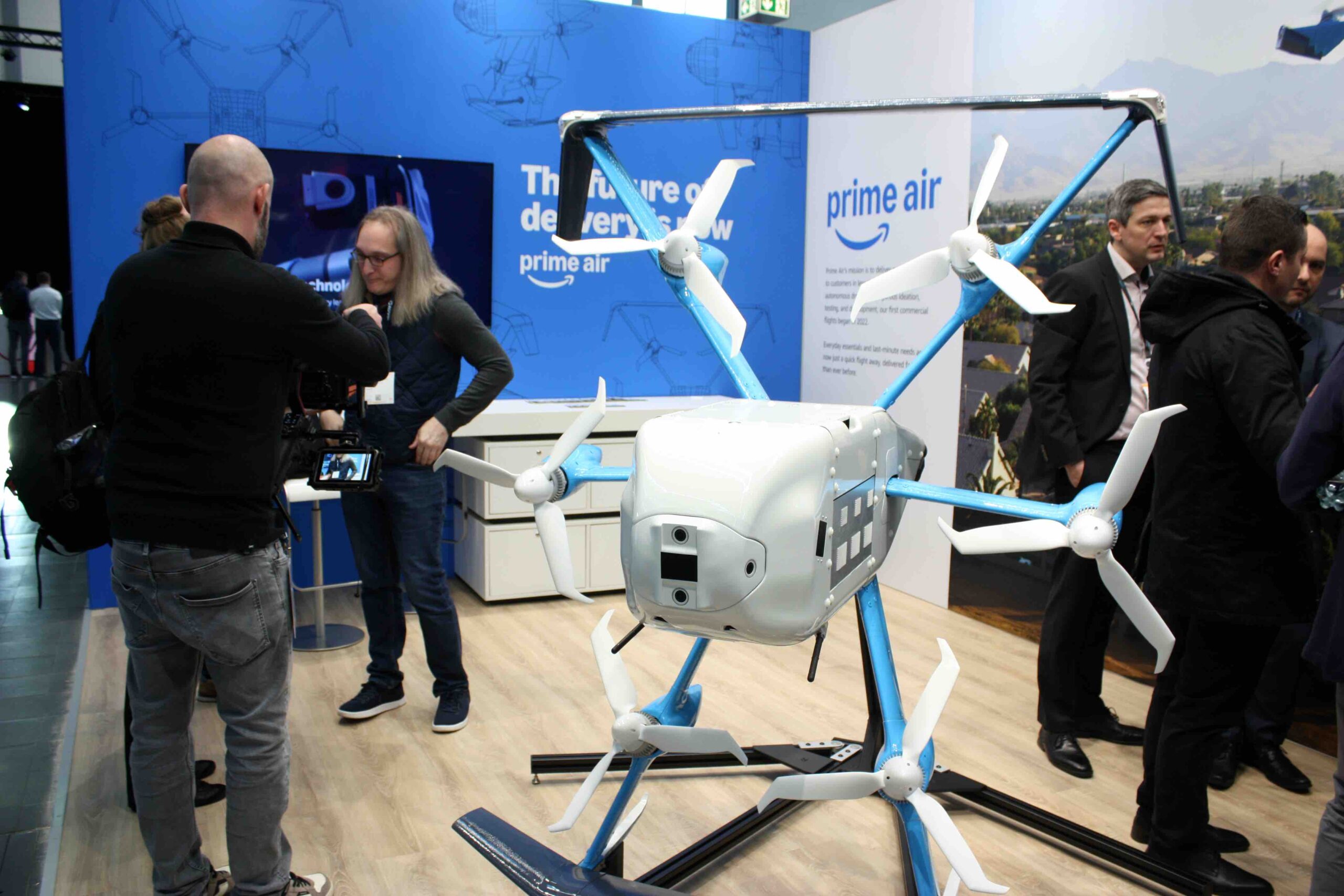
Amazon Prime Drone Delivery at XPONENTIAL Europe
Amazon is using drones to deliver packages in North America, and the company came to Germany to talk about it ...

UK Civil Aviation & Communications Authorities Make 978 MHz Frequency Available for UAS, Enabling BVLOS
Ofcom, the UK Communications Authority, and the UK Civil Aviation Authority (CAA) are making 978 MHz available for airborne transmission ...

Five Good Questions: Ethan Thornton, Mach Industries
Ethan Thornton is the CEO and founder of Mach Industries, a next-generation defense technology and manufacturing company. Thornton founded Mach by ...
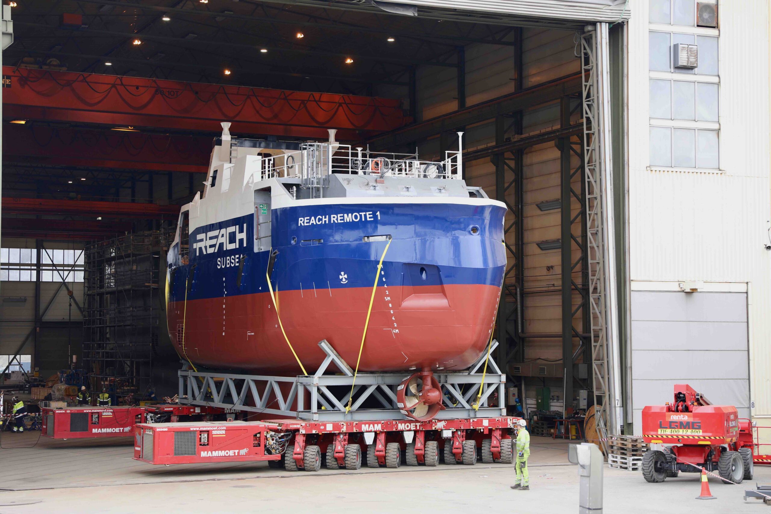
The Next Wave: Transforming Maritime & Subsea Operations
From advanced unmanned surface vessels (USVs) to cutting-edge synthetic aperture sonar (SAS) systems, maritime robotics is rapidly advancing offshore energy ...
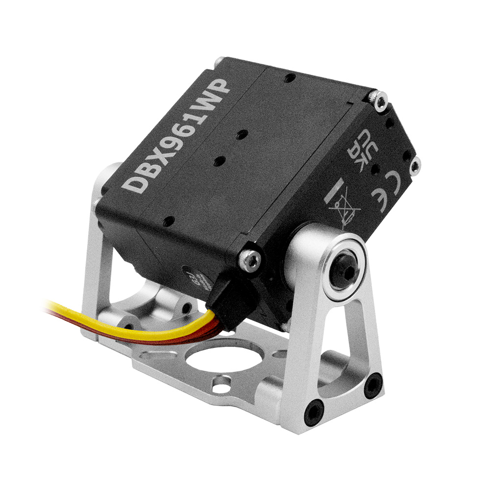
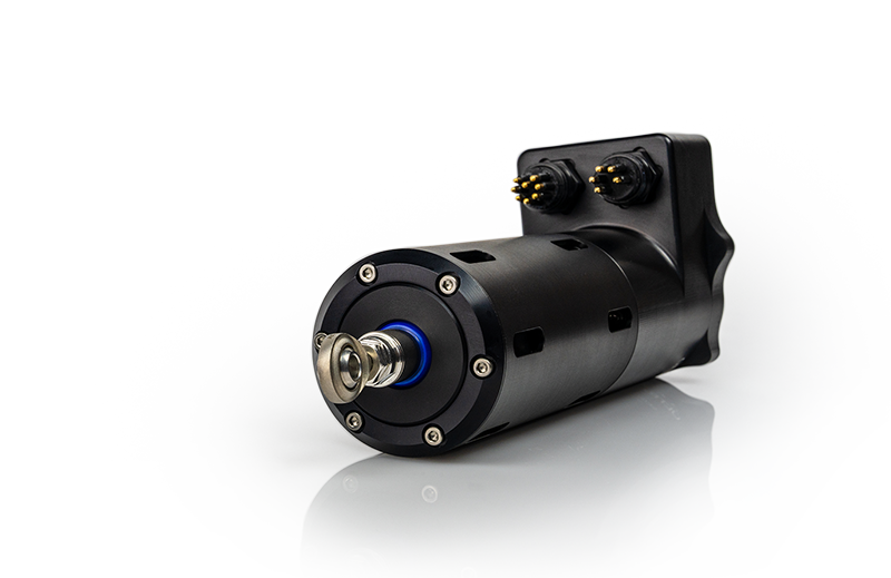
Hitec Releases DBX961WP Steel Gear Actuator
Engineered with hardened steel gears, dual ball bearings and a rugged aluminum alloy case, the DBX961WP with a bearing-supported robot ...
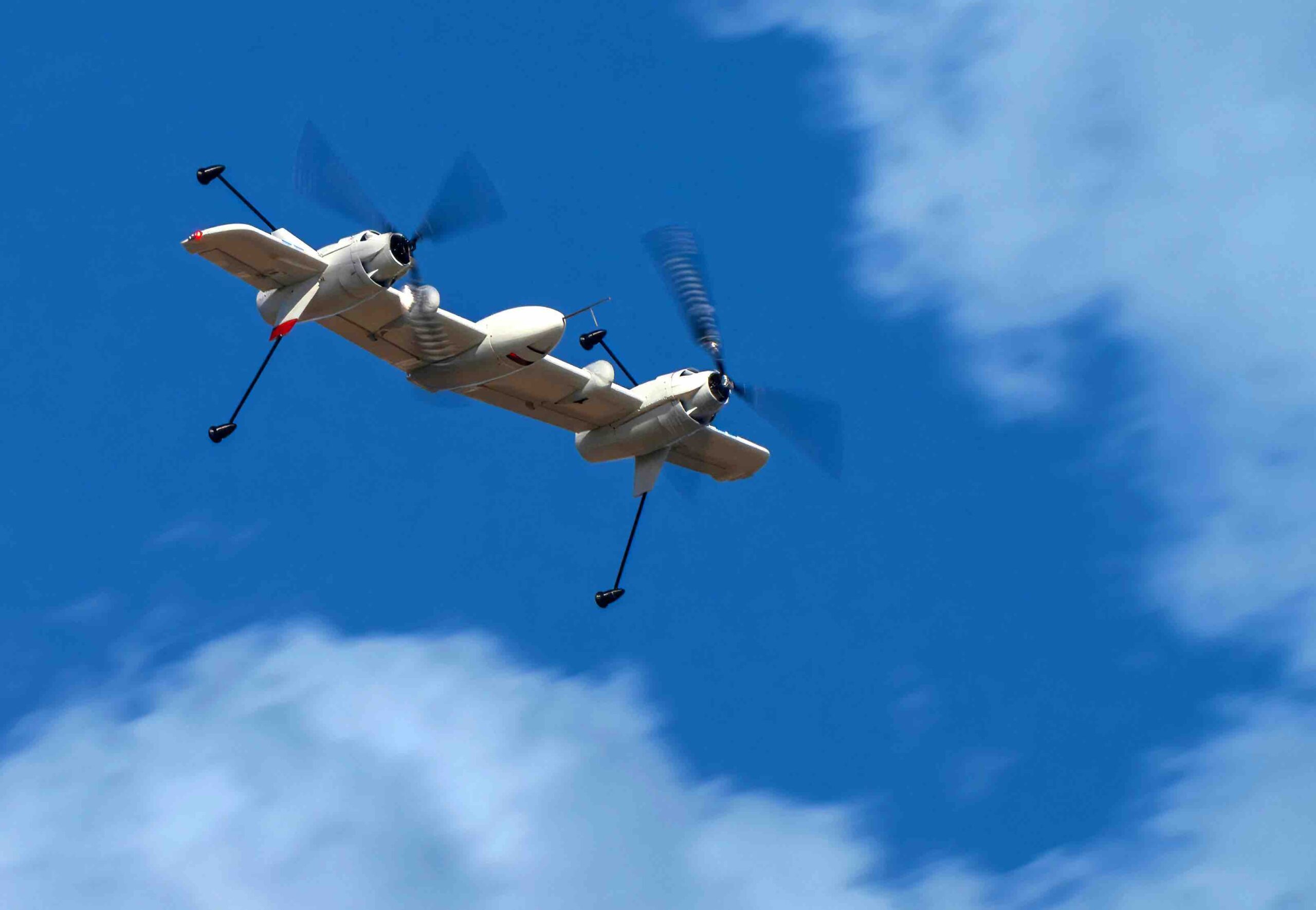
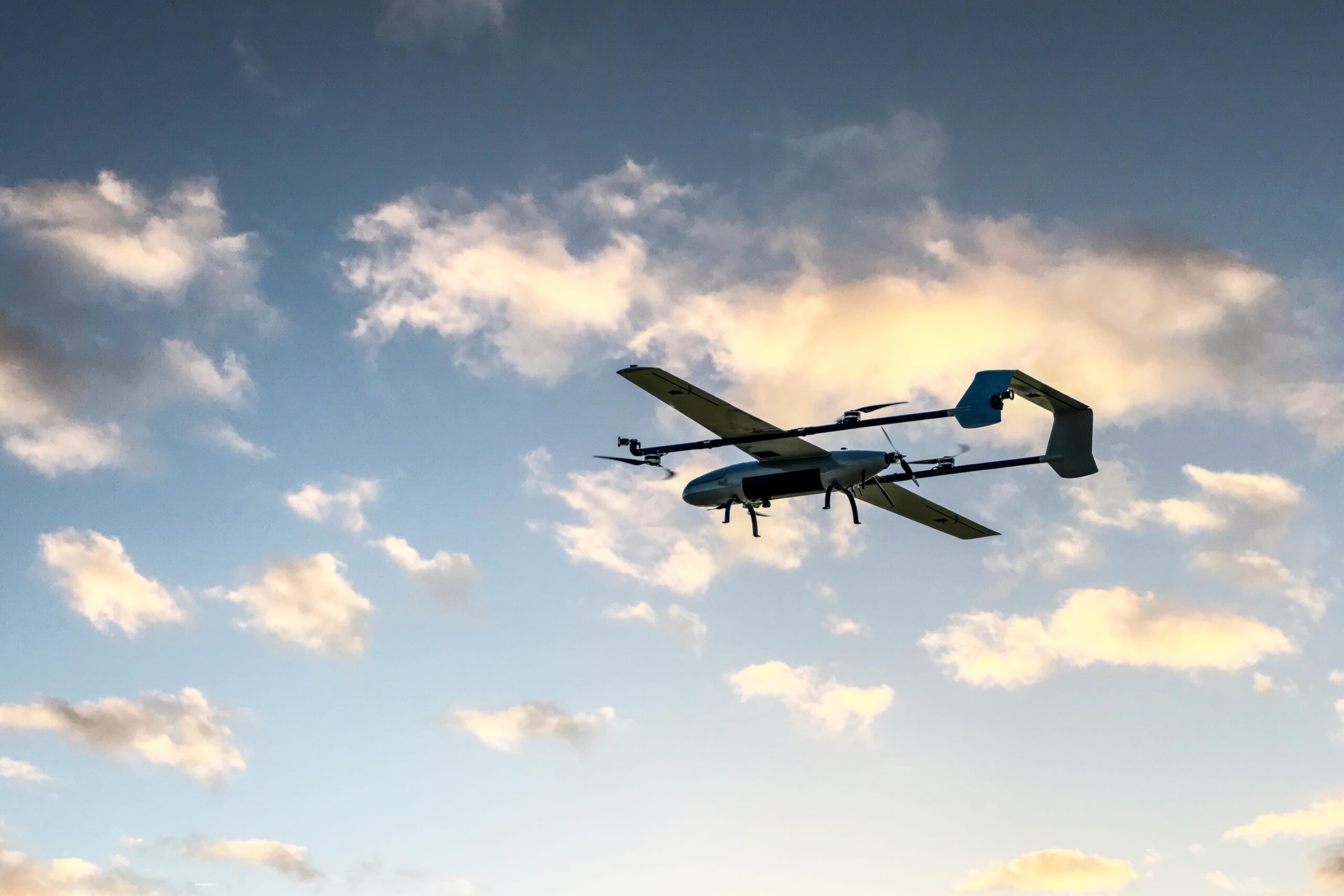
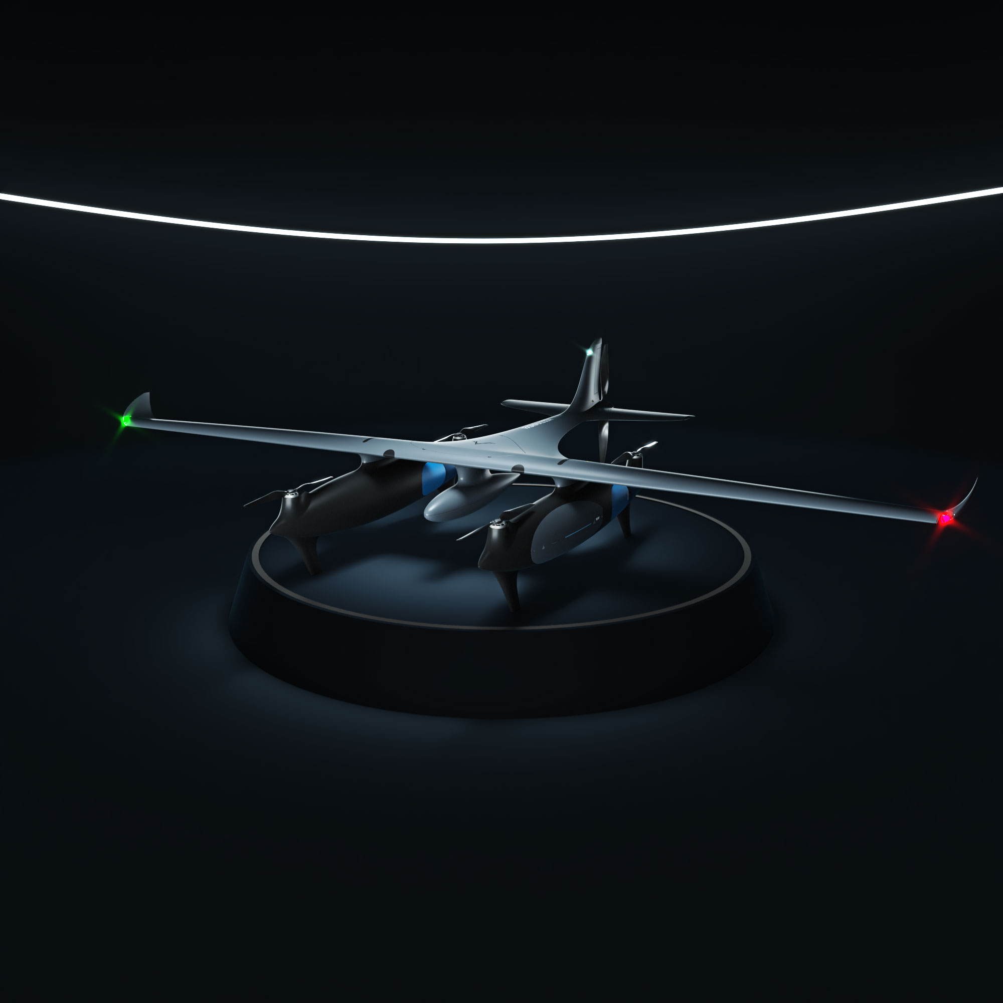
Sikorsky Successfully Flies Rotor Blown Wing UAS In Helicopter And Airplane Modes
Sikorsky, a Lockheed Martin company has successfully validated the advanced control laws to successfully fly a ‘rotor blown wing’ uncrewed ...
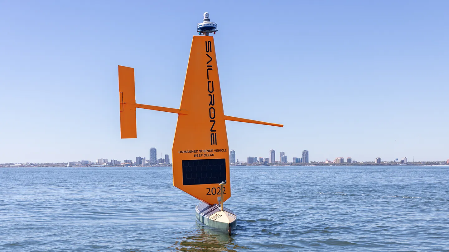
Saildrone Begins First Unmanned Survey of Florida’s Coastal Waters
Two Saildrone Voyager USVs have launched for the first time from St. Petersburg to map Florida’s coastal waters, supporting coastal ...
SightLine Applications Acquires Athena AI to Advance Autonomy Capabilities
SightLine Applications, a developer of video processing software for autonomous and uncrewed systems has announced the acquisition of Athena AI, ...
Ultra Motion: Actuators Driving Autonomy Across Air, Sea and Space
Ultra Motion’s advanced actuators deliver precision control in extreme environments. Their innovative solutions enhance reliability, efficiency and performance in autonomous ...

Bridging International Perspectives in Innovative Air Mobility
AUVSI recently launched XPONENTIAL in Europe, hosted by leading trade fair organizer Messe Düsseldorf. To kick off the programming, I ...
Shield AI Raises $240M to Scale Hivemind Enterprise Developer Platform
Shield AI, a deep-tech company building autonomy software products and defense aircraft, has announced it has raised $240 million. The ...
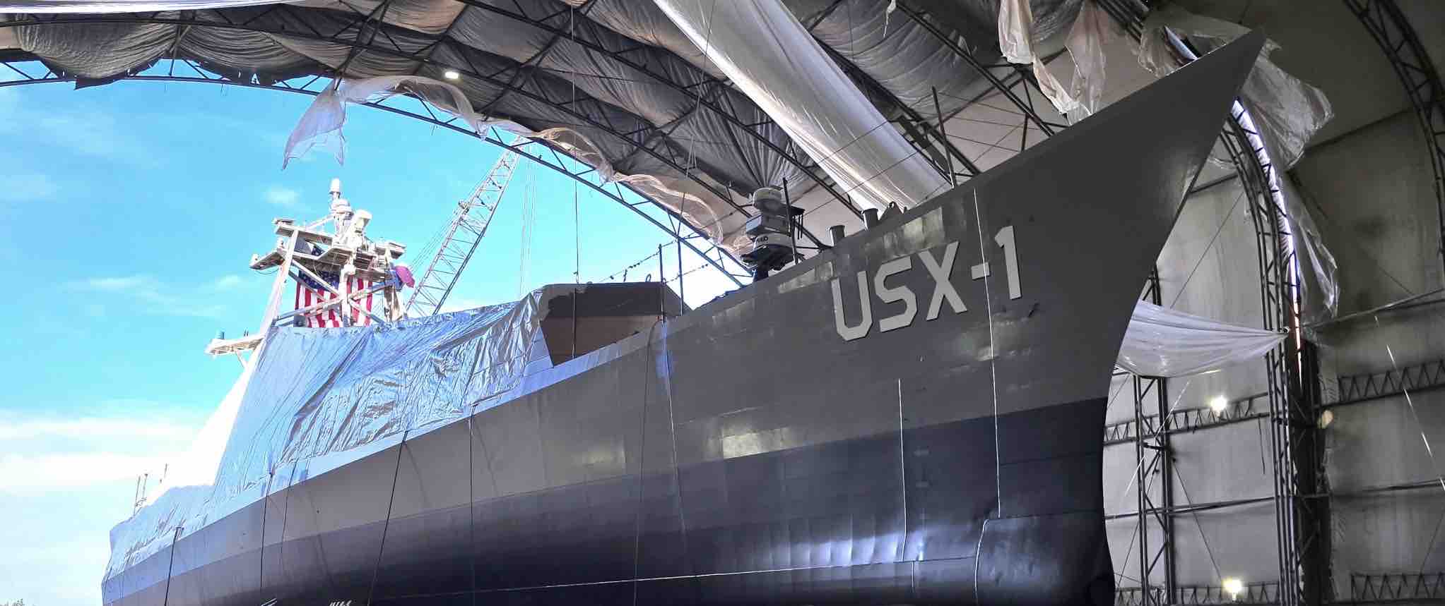
DARPA Launches NOMARS: No Manning Required Ship
The No Manning Required Ship (NOMARS) program has built a ship designed to operate autonomously for long durations at sea ...

Unlocking True Autonomy: Dynamic Neural Networks
To understand how dynamic neural networks function and why they matter for the future of autonomy, Inside Unmanned Systems spoke ...
Beyond the Buzz: Addressing the Realities of Drone Sightings with Advanced C-UAS Solutions
Editor’s Note: As attention has increased regarding aircraft activity in the eastern U.S., Inside Unmanned Systems will be providing substantive ...

uAvionix Casia G Now Detects Aircraft at Night, Enabling 24/7 BVLOS Operations
uAvionix, a provider of aviation technology for uncrewed aircraft systems (UAS), today announced the launch of Casia G Release 4.0, ...

Mitsubishi Heavy Industries Delivers Merging Support Information System for Autonomous Trucks
Mitsubishi Heavy Industries, Ltd. (MHI) and Mitsubishi Heavy Industries Machinery Systems, Ltd. (MHI-MS), will participate in Japan’s first trial project ...
Lockheed Martin Unveils Scalable Counter-UAS Solution
As the threat of small Unmanned Aerial Systems (UAS) continues to evolve, Lockheed Martin is demonstrating a new approach to ...

DroneDeploy and GEODNET Foundation Announce Partnership to Provide Enterprise RTK Services for Drone-based Reality Capture
DroneDeploy, an aerial and ground reality capture and robotics platform, has announced the signing of a partnership agreement with the GEODNET ...
HEIGHT Technologies and Auterion Announce Collaboration to Advance ISR Drone Technology and Interoperability
HEIGHT Technologies, a designer and manufacturer of Intelligence, Surveillance, and Reconnaissance (ISR) drones, better known as the “Martlet Family Of ...
TEKEVER Partners with IMSAR to Advance Radar Technologies and Data Processing Solutions
TEKEVER, a European provider of unmanned aerial systems (UAS), has announced a two-year partnership agreement with IMSAR, a US-based company ...
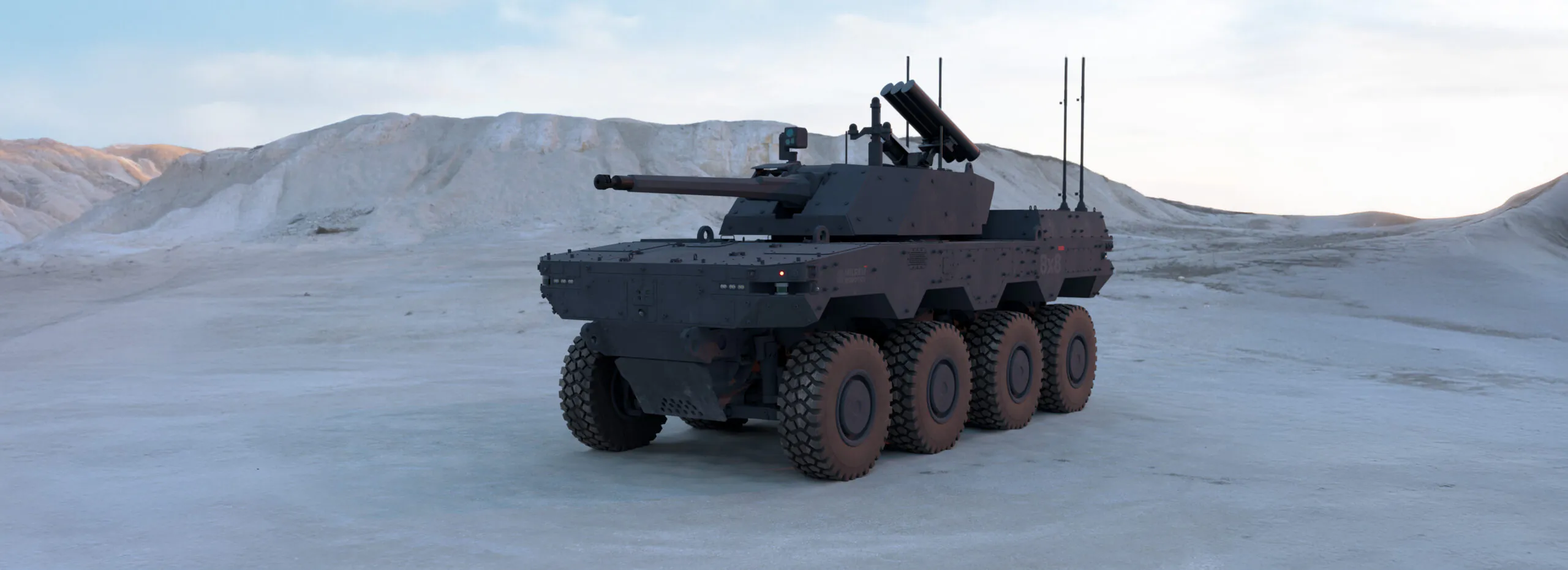
Milrem Robotics Debuts HAVOC Robotic Combat Vehicle (RCV) at IDEX 2025
Milrem Robotics, an Estonian robotics and autonomous systems developer, launched its 8×8 Robotic Combat Vehicle (RCV) at IDEX 2025. The ...
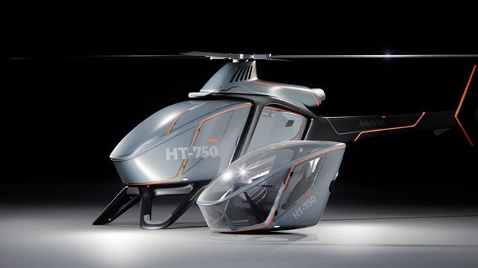
EDGE Launches ANAVIA HT-750 UAV at IDEX 2025
Among several new EDGE solutions being launched in the air domain is the ANAVIA HT-750, a high-technology rotary-wing unmanned heavy-lift aircraft ...
New Platforms Added to DIU Blue UAS List
After three days of flight demonstrations at the Blue UAS Challenge at Marine Corps Air Ground Combat Center 29 Palms, ...

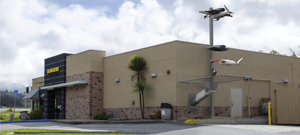
AeroVironment Unveils JUMP 20-X for Autonomous Maritime Operations
AeroVironment (AV) has announced the launch of the JUMP® 20-X, a next-generation, modular Group 3 uncrewed aircraft system (UAS) designed to ...
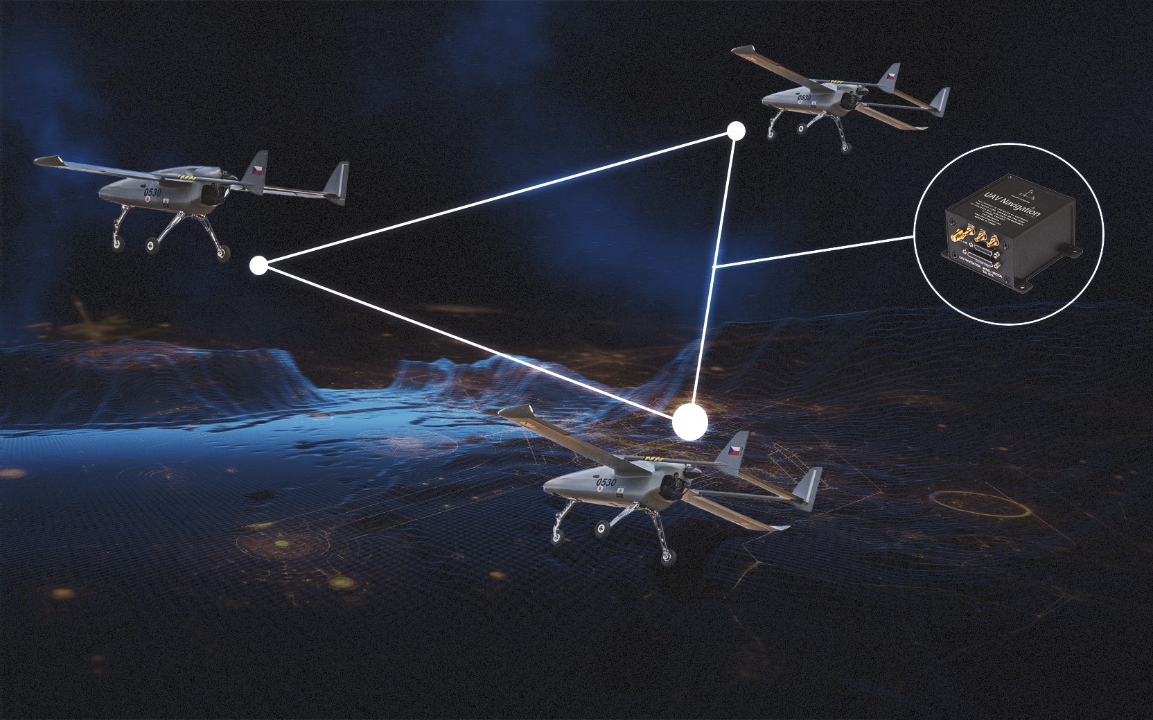
UAV Navigation-Grupo Oesía and Primoco UAV SE Demonstrate Manned-Unmanned Teaming (MUT) and Swarm Capabilities
In a recent flight test campaign UAV Navigation-Grupo Oesía and Primoco UAV SE showcased the integration of advanced guidance, navigation, and control (GNC) technologies with ...
Beyond the Last Mile: Zipline’s Zero-Emission Solution to Urban Delivery
Drone delivery is on the cusp of reshaping the logistics landscape by significantly reducing emissions and eliminating unnecessary packaging waste ...

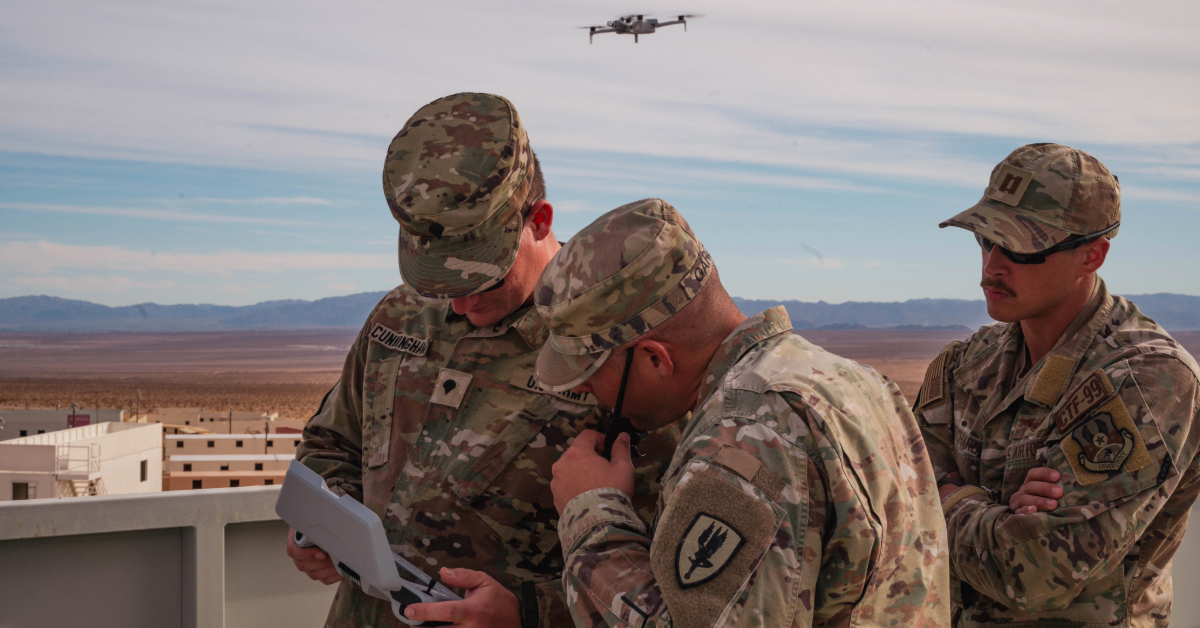
AWSAC 2025: Bringing Together Army Security Assistance Enterprise (ASAE) and U.S. Industry
The upcoming Army Worldwide Security Assistance Conference (AWSAC), March 5-7 in Crystal Springs, VA, will bring together members of the ...
Heven Launches the Raider Hydrogen-Powered Drone
Heven, a producer of hydrogen-powered drones, has announced the debut of its Raider platform. The platform is designed to provide ...
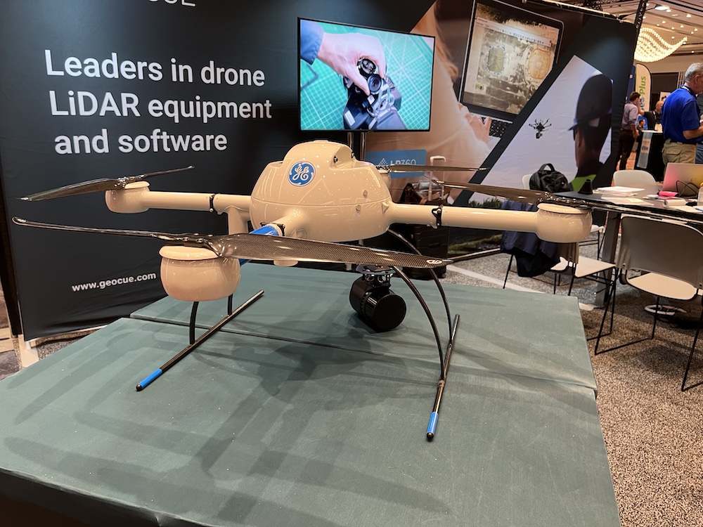
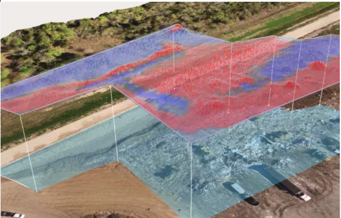
GEOCUE Adds Third Camera to LiDAR Scanner
A GeoCue 655/660 unit (below the drone) offers three cameras including a nadir camera. Photo by Neesa Sweet. Surveyors and ...
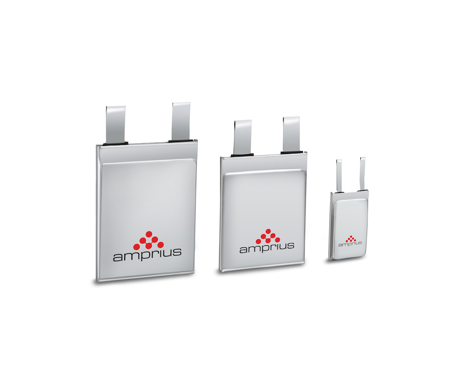
Amprius Puts Silicon to Work
Ronnie Tao, vice-president business development for Fremont, California-based Amprius Technologies, is enthusiastic about his company nearly doubling the energy density ...
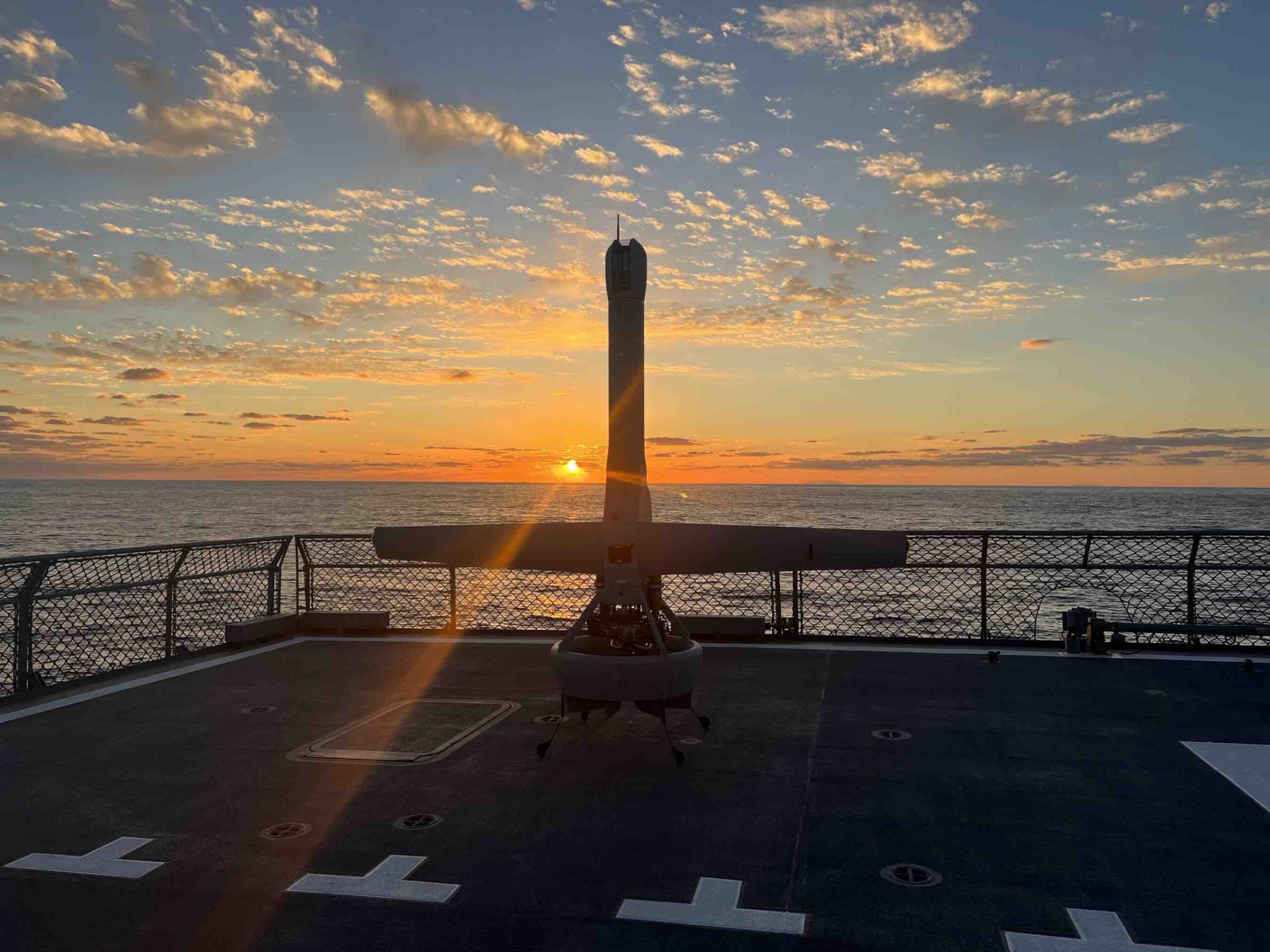
AeroVironment Introduces Next-Generation All-Electric VAPOR 55 MX Helicopter Unmanned Aircraft System
VAPOR 55 MX is more rugged and packable than its predecessor and can stay in the air longer, hover and ...
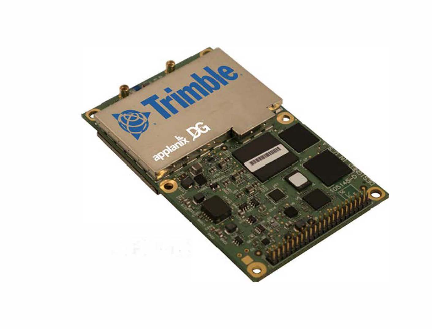
Applanix Tells You Where Things Are
Richmond Hill, Ontario-based Applanix, a subsidiary of Sunnyvale, California-based Trimble, talked about its Direct Georeferencing Unit at the recently concluded ...
AeroVironment’s New Mantis i23 D Multi-Sensor Imaging Payload Delivers Superior Daytime Surveillance Performance
An enhanced daylight variant of its predecessor, the Mantis i23, Mantis i23 D maintains its ruggedized design ...
A2Z Drone Delivery Launches RDS2 Winch and New Cargo Drone
A2Z Drone Delivery recently introduced the second generation of its Rapid Delivery System (RDS), the RDS2. The delivery winch is ...
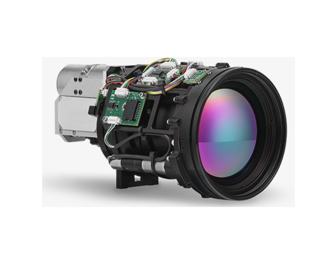
Teledyne FLIR Announces the Neutrino LC CZ 15-300 Demonstrating Rapid MWIR Integration Capability
Latest ITAR-Free Neutrino IS series module offers best-in-industry performance and improved time-to-market for commercial, industrial and defense applications. Teledyne FLIR, ...
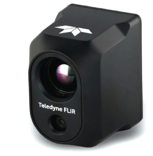
New Products from Teledyne FLIR
The Hadron 640R offers compact high-end dual thermal and visible camera performance Teledyne FLIR is moving forward with two camera ...
Tyto Robotics Releases New Drone Test Stand: The Flight Stand 15/50
Flight Stand 15 (left) and Flight Stand 50 (right) Tyto Robotics has officially released the long-anticipated ‘Flight Stand’, the newest ...

New SEA-KIT H-class USV Designed For Ocean Survey
SEA-KIT International recently revealed its new H-class uncrewed surface vessel (USV) for ocean survey, with a design that focuses on ...
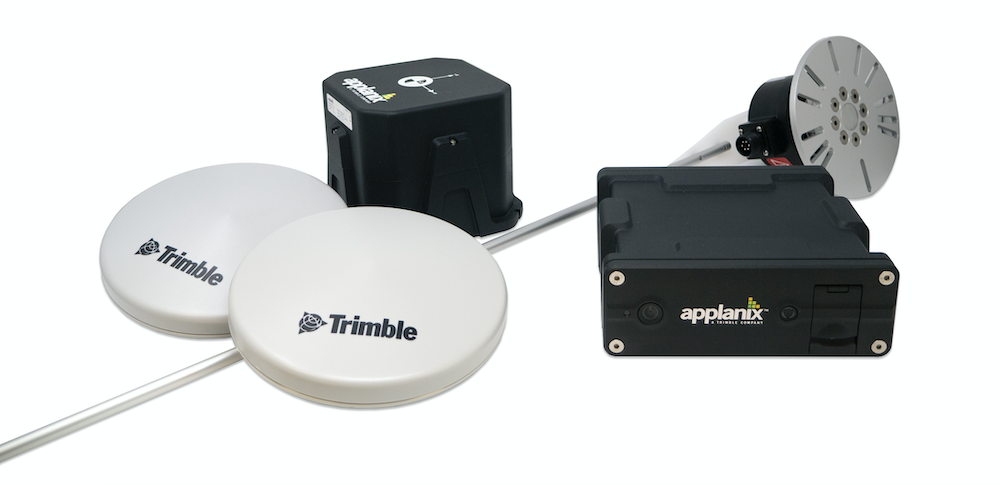
Trimble Announces New Deployment of Applanix’s POS LV to Enable Broader Autonomy Capabilities for IHI Corporation
Customizable System Provides Robust Positioning Without Added Site Infrastructure Trimble announced today the first deployment of its map-based localization system ...
Propeller Aero, Quantum-Systems Partner
Propeller Aero’s site surveying and 3D mapping software is now compatible with the Trinity F90+ drone from Quantum-Systems, streamlining data ...

The New Ninox 103 Sub-to-Air Loitering UAS From SpearUAV Launches Underwater
SpearUAV has released the encapsulated Ninox 103 Sub-to-Air loitering UAS, which enables the underwater launch of submarine drones into the ...
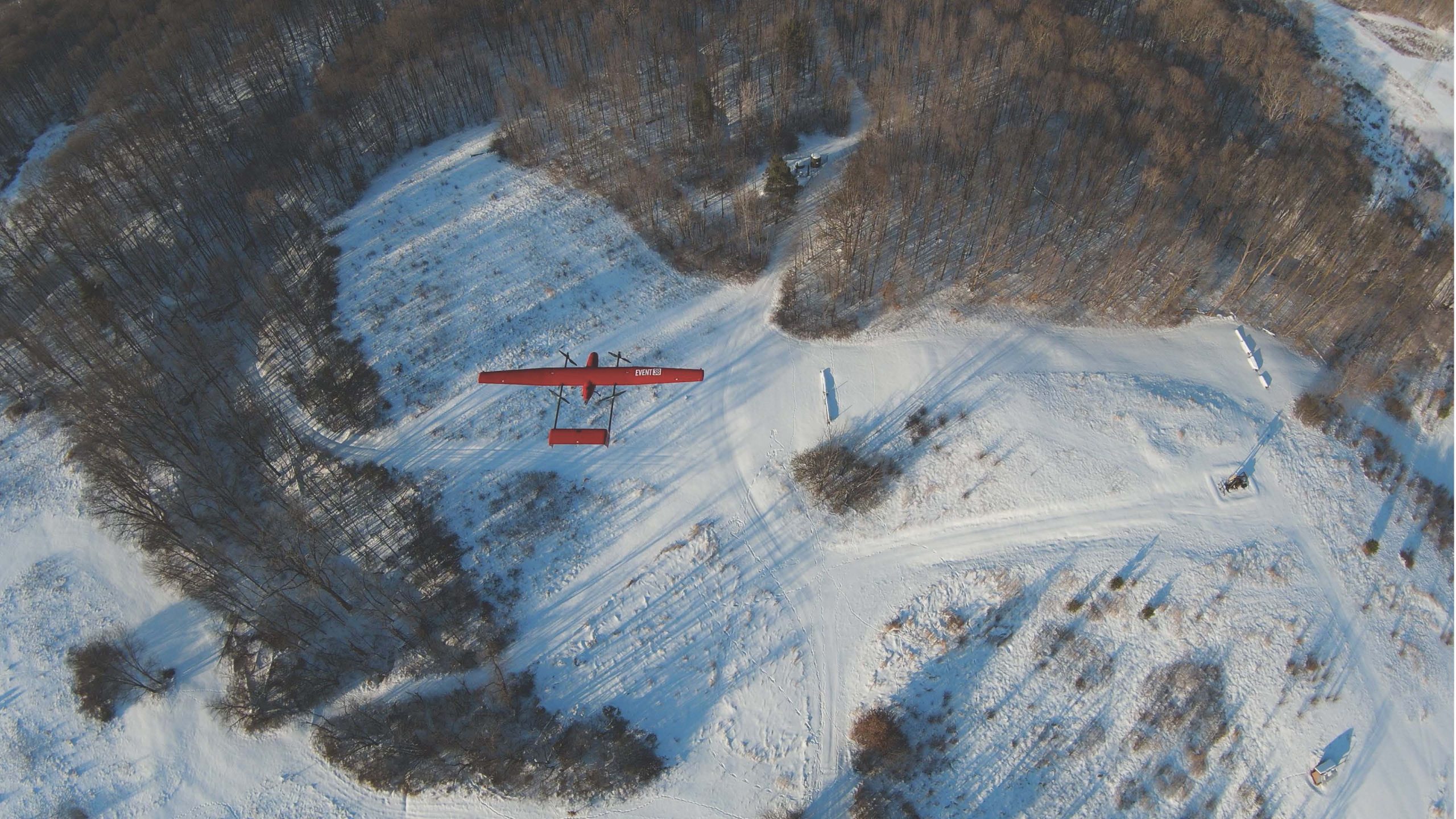
Event 38 Unmanned Systems Releases E400 Fixed-Wing VTOL Mapping Drone
Event 38 Unmanned Systems recently introduced the E400, a fixed-wing VTOL mapping drone with a payload capacity of 3 pounds ...

Transparent Sky Enters Wide Area Motion Imaging Market with First-of-its-Kind Sensor
United States Air Force taps into ability to view live 3D maps of any area Transparent Sky, a company pioneering ...
No posts found.